Category: Big Blows

The Day Before Thanksgiving

What could possibly go wrong?

GIVEN THE POTENTIAL FOR MAJOR TRAVEL DISRUPTION DURING THE PEAK PRE THANKSGIVING TRAVEL PERIOD ON TUESDAY AND WEDNESDAY…THE FORECAST FOR THIS STORM IS QUITE CRUCIAL. A SIGNIFICANT CYCLONE IS EXPECTED TO DEVELOP IN THE EASTERN GULF OF MEXICO ON TUESDAY EVENING AND THEN RIDE UP ALONG THE EAST COAST ON WEDNESDAY. A BAND OF SIGNIFICANT QPF IS EXPECTED TO DEVELOP WITHIN THE ENTRANCE REGION OF A 200 KT 250 MB JET OVER THE NORTHEAST. NOT UNEXPECTEDLY…THERE ARE QUITE A NUMBER OF DIFFERENT SOLUTIONS WITH VERY DIFFERENT IMPACTS. RIGHT NOW…THE MOST SIGNIFICANT DIFFERENCES INVOLVE WHETHER THE STORM BECOMES RATHER INTENSE ON A SLIGHTLY MORE WESTERLY TRACK VERSUS A SLIGHTLY WEAKER MORE EASTERLY TRACK…THOUGH THERE MAY ME A TREND TOWARD SOME MIDDLE GROUND BETWEEN THESE FORECASTS. IN EITHER EVENT…SIGNIFICANT SNOW IS POSSIBLE ALONG THE I95 CORRIDOR..WHETHER OR NOT IT IS ALONG THE CORRIDOR OR SLIGHTLY WESTWARD. THE DETERMINISTIC FORECAST MADE SHOWED THE HEAVIEST SNOW JUST INLAND WITH SOME ACCUMULATIONS IN THE BIG CITIES REFLECTING A COMBINATION OF RAIN CHANGING TO SNOW.

SNOW IS EXPECTED TO INITIALLY DEVELOP ALONG THE APPALACHIANS ON
TUESDAY EVENING/NIGHT…POSSIBLY AS FAR SOUTH AS THE HIGHER
ELEVATIONS OF NORTHEAST GEORGIA ACROSS NW SOUTH CAROLINA/WESTERN
NORTH CAROLINA AND WESTERN VIRGINIA AND EASTERN WEST VIRGINIA.
SNOW AND COASTAL RAIN SHOULD CONTINUE TO SPREAD NORTHEASTWARD
ACROSS THE REST OF THE EASTERN SEABOARD ON WEDNESDAY/DAY 3…THE
PEAK OF THE PRE HOLIDAY TRAVEL AND THEN END ACROSS EASTERN MAINE
ON THANKSGIVING MORNING.

HOWEVER…THIS SCENARIO IS MERELY ONE OF MANY THAT TYPIFY
POTENTIAL SIGNIFICANT SNOW EVENTS ALONG THE EAST COAST.

All this snow is PROOF of Gerbil Warmening.

or something.

39 Years Ago The Gales Of November Came Early

Ruh-Roh

It’s been quiet…too quiet

Gulf of Mexico:

1. Satellite images and surface observations indicate that the area of
low pressure in the southern Bay of Campeche has become better
defined. Although the associated showers and thunderstorms are
currently not well organized, this system has the potential to
become a tropical cyclone during the next day or so while it moves
slowly eastward toward the western Yucatan Peninsula. Later in the
week, the low is forecast to interact and possibly merge with a
frontal system over the southeastern Gulf of Mexico or northwestern
Caribbean Sea. An Air Force Reserve reconnaissance aircraft is
scheduled to investigate the disturbance this afternoon. Interests
in the Yucatan Peninsula should monitor the progress of this system.
* Formation chance through 48 hours…medium…40 percent.
* Formation chance through 5 days…medium…50 percent.

Y’all know the drill.

I’m SO Grateful Ebola’s Safe

But yuck.

The only saving grace in the forecast is a weakening before it hits the southern tip of Japan. Down to a what we’d call a strong 2/mid cat3 ~ 100 kts, gusts to 125 kts. Hope that works out.

Lord, I hate big storms.

That’s Not A Knife Storm…

This is a storm

lindseyvongphong

It looks like she’s turning much more westerly than they were reckoning yesterday.

Typhoon Vongfong Grazes Guam

For that we give thanks. But now it seems that the potential exists for something a bit messier: she is expected over the next few days to strengthen to a Super Typhoon, i.e. with winds in excess of 150 mph, and potentially threaten Japan.

Oh, and the chance exists of a dead-on strike at Fukushima.

What could possibly go wrong?

Mt. Ontake Erupts

At least 30 hikers are dead according to CNN.

Good lord, those poor folks…when that ash cloud comes roaring down at you there’s no where to run.

An Anniversary Post Reprint: Very Early This Morning

…ten years ago today…

…Ivan was busy blowing through major dad’s office.

Read more »

Ten Years Ago Today

Hurricane Ivan. Some of my posts.

So, Right About Now ~ 9:15 P.M., 2004 ~ The Phone Rings

…and it’s the Mountain Man.

“So, what the fuck you gonna do?”

“What’re you talking about?”

“The hurricane! What the fuck you gonna do?”

“Oh, we’re okay. It’s going to Biloxi.”

“No, it’s not. It’s headed right towards you.”

“WHAT? Where’d you hear that?! Ebola! Change the channel to John Ed!”

Oh, well…shit. All those freakin’ calculations about how far Biloxi was (131 miles), how far out the Cat 4 winds extended, how far out the hurricane winds extended, wasted. And I hear about it from Seattle! The next phone call was Bingster and NJSue…saying “good-bye” as upbeatedly as they could. How did everybody know but me? Just my luck, but it probably saved me a couple hours worth of fruitless worrying that I could do nothing about.

What to do when the house was already as cold as a meatlocker (in anticipation of power loss coupled with a closed house ~ not comfortable after even an hour or two with three adults), all the “valuables” were tripled wrapped in Hefty garbage bags and stuffed into the dishwasher, oven (both of which then had their doors locked) and the dryer (door duck-taped). Paintings, etc. were up on the beds in case we flooded. Both tubs were filled to the brim and covered with shower curtains to preclude evaporation, while every pot and pitcher was filled with tap water, as well as both sides of the kitchen sink and the washing machine. I had a spot cleared in the back hallway and ebola’s mattress staged in case the roof went and we had to get major dad someplace safe. (I remembered the ‘mattress as head cover’ trick from someone’s description of Andrew)

That’s part of my peace with these things ~ anal retentive preparation.

And nothing to do but wait.

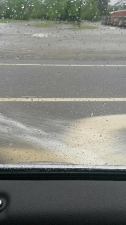
Gulf Power kept us lit until about 10:30 or so ~ pretty damn admirable, considering how biblical it was when the power finally did poop out. The hand helds we were using between the Squid Terrorist and us crackled through the night with voices from the apartments near us, some folks using the same channel. Comforting at first and we’d just switch around them. But as the wind started to rise and the rock ‘n rollin’ began in earnest, it got pretty disconcerting. Because they were scared. Really scared. The roof had started to drip or the door’d flew open. One fellow we heard tore our hearts out.

“Help me. Please help me. Is there anybody out there?”

There was and we were, but all we could do was offer encouraging words. And change up the channels again, because we needed to know we’d conserved the batteries as best we could in case WE needed to let the other household know we were in big trouble. Not that they could have done anything, either, but they’d come looking for us in the morning.

It’s freakin’ grim. The roof is flexing in ways I’d never imagined and rain is being driven in the roof vents, so that there’s a teeny little snake of damp spreading its way across the center of the cathedral ceiling. The noise is deafening. Indescribably evil.

All I can do is wander from one part of the house to the other ~ checking ceilings for leaks, God knows what I’m looking for. I’ve got a little circuit I’m repeating over and over, but I’m always drawn back into our bathroom. There, in all the cacophony of the heavens gone mad, right above the linen closet…is emanating the teeniest, tiniest, most terrifying, barely audible squeak of all time.
“EE-yah. EE-yah.”
The rafters flexing and I fixated on it.

“Mom, will you sit DOWN?!” Ebola saved me with his crankiness. We settled in to listen to John Ed on the radio. You learn pretty cool things in a situation like that. For instance, someone called in (WHO still had a freakin’ operable phone?!?!) and asked about the old wisdom of “open a window to even the pressure”. No one had an answer that second, but, a couple minutes later, an engineer called in to insist one should NEVER EVER open that window. Apparently modern houses are built so “tight” that an opening ~ be it door, window, etc ~ allows all that pressure to flow into the house with no exit. Right up to where your roof blows like a giant Jiffy Pop bag.

Who knew?

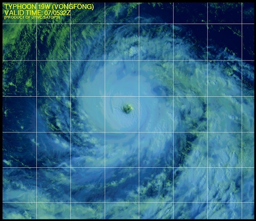
By 1 a.m., 16 September, Ivan was roaring outside with everything he had. So I thought.

By 3 a.m., Ivan was making it abundantly clear that he’d just been warming up and I was pretty thankful the batteries were keeping the radio humming along, since we needed the distraction. You start thinking “couple more hours, couple more hours”, but you’re just faking yourself out, since no one really has a clue what the storm will do. It’s pretty much calling its own shots and you’re just there for the ride, if you’re foolish enough to be in the way.

Ebola and I had long ago shoved the 3 stacked coolers (with 60-80 lbs of ice per) against the front door, and were continually wringing out sodden beach towels from the wind driven seepage. You could call us “preoccupied” when the walkie talkie lit up, and it was the Squid Terrorist. It was mildly upsetting to hear the, um, “frantic” in his voice while the Furies shrieked and screamed overhead and all around.
He was in the process of hammering 2 X 4’s across his bowing front door, threatening to use the china cabinet when he ran out of that wood (“Not MY china cabinet, you don’t!” we heard in the background.). Because, he shouted:

“It sounds like the Devil’s trying to beat his way in!”

He was. He had certainly come to town.

XBOX One Has Arrived

Oops, sorry, that’s TropDep One

BULLETIN
TROPICAL DEPRESSION ONE ADVISORY NUMBER 2
NWS NATIONAL HURRICANE CENTER MIAMI FL AL012014
500 AM EDT TUE JUL 01 2014

…DEPRESSION LIKELY TO BECOME A TROPICAL STORM LATER TODAY…

Yep, July 4th will probably suck on Hatteras…

Deluge-A-Cola

Sis says they got nearly 27 inches of rain at the airport last night.

This is a pic she took on a street near her house

deluge

Class V rapids on your roads are not fun.

My Kind Of Precise Forecast

From the Extended Forecast page of the National Weather Service

…SENSIBLE WEATHER HIGHLIGHTS…
LIGHT TO MODERATE RAIN/SNOW IN THE WEST WILL TRANSLATE EASTWARD
AND INCREASE IN COVERAGE AS THE SYSTEM DEVELOPS ALONG THE NORTHERN
GULF COAST SAT/D4 INTO THE SOUTHEAST SUN/D5. A WELL-DEFINED SYSTEM
SHOULD MOVE UP ALONG THE COAST AND THEN EXIT NORTHEASTWARD INTO
THE CANADIAN MARITIMES MON/D6 AND WELL INTO ATLANTIC CANADA BY
TUE/D7. PRECIPITATION COULD BE ROBUST… OR COULD BE NEXT TO
NOTHING
…FOR SOUTHERN NEW ENGLAND.

They get points for honesty.

Pensageddon 2014

So You Trot Out THE FACTS and Gorebal Warming Types Can Only Answer…

“The SCIENCE IS SETTLED!!!”

Global warming skeptic buries Sierra Club director under avalanche of facts [VIDEO]

Marc Morano, a global warming skeptic and the editor of ClimateDepot.com, fought the climate sob stories peddled by Sierra Club Director Michael Brune with cold, hard facts on CNN Tuesday night.

“‘Global weirding’ is nothing more than a pseudoscience expression,” he said on Don Lemon’s “11th Hour,” pushing back against Lemon’s contention that the “extreme” cold weather wracking much of the country is a symptom of climate change.

“So record cold is now evidence of man-made global warming,” Morano said sarcastically. “What evidence would disprove climate change? It seems that no matter the weather, everything that happens proves it.”

And then the Warmener goes right on to prove that point.

A Nice Ensnowification

Nanook Ferry Service

20131210-090238.jpg

20131210-090416.jpg

How Very Odd

Are they setting off charges for the Keystone pipeline?

What a weird series of earthquakes: three in Oklahoma and one in Texas running more or less on a straight line.

A Bad Hair Day

Man oh manachevitz, is it messy today. It’s like living in a car wash!

Everyone who has to travel in the NE be safe.

Oh, and it’s 60

And tomorrow it will be 20

Oh Crap Already

Like they need this

1. FORMATION OF A SIGNIFICANT TROPICAL CYCLONE IS POSSIBLE WITHIN
190 NM EITHER SIDE OF A LINE FROM 6.2N 130.7E TO 9.8N 121.5E
WITHIN THE NEXT 06 TO 24 HOURS. AVAILABLE DATA DOES NOT JUSTIFY
ISSUANCE OF NUMBERED TROPICAL CYCLONE WARNINGS AT THIS TIME.
WINDS IN THE AREA ARE ESTIMATED TO BE 18 TO 23 KNOTS. METSAT
IMAGERY AT 111530Z INDICATES THAT A CIRCULATION CENTER IS LOCATED
NEAR 6.8N 129.9E. THE SYSTEM IS MOVING NORTHWESTWARD AT 19 KNOTS.
2. REMARKS: THE AREA OF CONVECTION PREVIOUSLY LOCATED NEAR 5.0N
136.8E IS NOW LOCATED NEAR 6.8N 129.9E, APPROXIMATELY 473 NM EAST OF
ZAMBOANGA, PHILIPPINES. ANIMATED INFRARED SATELLITE IMAGERY DEPICTS
A CONSOLIDATING LOW-LEVEL CIRCULATION CENTER (LLCC) ASSOCIATED WITH
FLARING DEEP CONVECTION. AN 111231Z METOP-A 89 GHZ IMAGE INDICATES A
PARTIALLY EXPOSED LLCC WITH THE BULK OF THE DEEP CONVECTION SHEARED
OFF TO THE WESTERN QUADRANTS OF THE SYSTEM. AN 111231Z ASCAT
IMAGE SHOWS AN ELONGATED CIRCULATION WITH 20 KNOT WINDS WITH SOME
ISOLATED 25 KNOT WINDS OVER THE NORTHERN SEMI-CIRCLE. UPPER-LEVEL
ANALYSIS INDICATES LOW (5 TO 10 KNOTS) VERTICAL WIND SHEAR AND GOOD
RADIAL OUTFLOW. MAXIMUM SUSTAINED SURFACE WINDS ARE ESTIMATED AT 18
TO 23 KNOTS. MINIMUM SEA LEVEL PRESSURE IS ESTIMATED TO BE NEAR 1003
MB. THE POTENTIAL FOR THE DEVELOPMENT OF A SIGNIFICANT TROPICAL
CYCLONE WITHIN THE NEXT 24 HOURS REMAINS HIGH. THIS SUPERSEDES REF A.
3. THIS ALERT WILL BE REISSUED, UPGRADED TO WARNING OR CANCELLED BY
121700Z.//

because naturally it’s heading…

notagain

Yep, there.

TEN THOUSAND PLUS DEAD, Millions in Dire, Terrible Need and the Politically Correct, Ever-So-Educated HuffPo Crowd

…is putting out tweets like this:

GOD, their self-absorbed smugness BURNS MY ASS.

I’ve NEVER met ANYBODY like the Salvation Army in a major disaster zone and I’ve been in THREE. They’re the first in, the last to leave and they work their asses off 24/7 to help EVERY SINGLE SOUL IN NEED, it doesn’t matter if you’re black, white, orange, green, purple, gay, bi, straight or zombie. They want YOU taken care of as best they can and they do it.

From a previous post with Hurricane Katrina overhead:

UPDATE: While I can get online, let me first thanks Bingster for posting this, but please, please let me add my fervent appeal for your donations to go to the Salvation Army. We have unfortunately gotten to see all the aid agencies in action. The Salvation Army has impressed us tremendously with their selflessness and dedication to people’s immediate needs and their continuing ones. They were literally a Godsend after Ivan and stuck around through thick and thin for months afterwards. For everybody. Feeding people, clothing them, sheltering them, holding hands, getting answers. If you need it, they’re there if there’s anyway on earth possible for them to be.

Not to mention the fact, they have the infrastructure, knowledge and well-oiled disaster relief machines to do it. With the ADDED BONUS that EVERY DOLLAR YOU SEND FOR THAT DISASTER GOES to RELIEF IN THAT DISASTER. Not like the predatious Red Cross (and other “relief organizations”), who reserve the right to use those dollars where “they see the need”, like headquarters, salaries and jaunts.

Oh, I am HOT.

ths update: Wow. She actually paid attention to my tweets in reply defending the Salvation Army. And learned something. How really nice. (And I MEAN that in the NICEST way possible.)

The Aftermath Of The Typhoon

The scenes of devastation are just starting to emerge and they are horrible.

Thousands dead, bodies everywhere, looting and the desperate search by the living for supplies while the government struggles with the logistical nightmare of trying to get relief to the area.

If you can, please give to the Salvation Army or other such organizations of your choice.

I just can’t begin to imagine the damage here if a storm with 200 mph winds came ashore.

Auntie Em! Auntie Em!

A very strong blustery front coming in to Manhattan

20131007-155415.jpg

Lovely ~ the Asshats Have the Commissary Closed

…and we have a developing hurricane coming.

Some things never change and ONE of them is MY SHITTY LUCK.

Super Typhoon Usagi

Usagi, which oddly enough means “bunny”, is splitting the gap between Taiwan and the Philippines with 165 mph winds. It is headed straight towards Hong Kong but should weaken to a mere 120 mph little fluffy thing by the time it comes ashore. Batten down them thar hatches!

I should also point out for those who have daughters similar in age to mine that “Usagi” is Sailor Moon’s first name so that you can truly appreciate the potential scope of this disaster.

Typhoon Hits Fukushima

But don’t worry: Tepco said they just pumped the extra water into the ocean.

No worries.

The Cinematic Tour de Force Of The Year

Hell, the Century.

Yes, Sharknado was that enjoyable.

redseat

Image | WordPress Themes