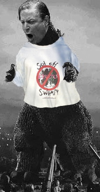
Da March Schnee, She Is Coming!
They’re so sexy when they talk like this
THEN ON MON… THE FORECAST BECOMES QUITE COMPLEX AND VERY
CHALLENGING OVER THE ERN PORTION OF THE COUNTRY. THE SHORT WAVE
DIVING THROUGH THE MIDWEST ON SUN PROCEEDS TOWARD THE SOUTHEAST ON
MON AND BEGINS TO INDUCE A SURFACE LOW NEAR THE COASTAL CAROLINAS
BEFORE SHOWING SIGNS OF INTENSIFYING AND LIFTING NORTHWARD. THIS
IS DUE TO A SLIGHT NEG TILT ALOFT OF THIS FEATURE AND THE NEXT
POLAR/ARCTIC UPPER TROUGH PLUNGING INTO THE UPPER MS VALLEY/GREAT
LAKES. DO THE TWO SYSTEMS REMAIN COMPLETELY SEPARATE OR IS THERE
ENOUGH PARTIAL PHASING OCCURRING. EITHER WAY… ONE OF THE RARE
COASTAL STORMS THIS WINTER COULD VERY WELL IMPACT PARTS OF THE
MID-ATL REGION MON AFTN/EVENING INTO TUES MORNING.THE 00Z ECMWF AND GFS APPEAR TO BE CONVERGING ON COASTAL
CYCLOGENESIS FROM THE CAROLINA COAST TO THE DELMARVA COAST… AS
THE UPPER DYNAMICS CROSS THE APPALACHIANS AND MESHES WITH THE
WOUND UP SURFACE SYSTEM ALONG THE COAST. THE RESULTANT SHOULD BE A
BURST AND FLOURISH IN PRECIPITATION AND GIVEN THE ANOMALOUS COLD
AIR MASS ENTRENCHED OVER THE EAST… IT APPEARS A RATHER
SIGNIFICANT LATE WINTER/EARLY SPRING HEAVY WET SNOW EVENT. NOW
EVEN THOUGH THE TWO LEADING GLOBAL MODELS HAVE COME TO SOME SORT
OF CONSENSUS… THIS REMAINS A HIGHLY FLUID FORECAST GIVEN
MULTIPLE STREAMS IN PLAY. THUS WPC QPF AND WINTER WEATHER
FORECASTERS WENT EXTREMELY CONSERVATIVE TO INTRODUCE INITIAL HEAVY
SNOWFALL AMOUNTS BUT NOT AS EXTREME AS SOME OPERATIONAL SOLUTIONS.
AT THIS MOMENT THROUGH 12Z TUES… WPC WENT WITH THE GREATEST
THREAT FOR SIGNIFICANT ACCUMULATIONS FROM SWRN VA TO ERN PA AND ON
THE ERN EXTENT TO INCLUDE THE CORRIDOR OF DC UP TO BWI AND JUST
SHY OF PHL… THOUGH THE REST OF THE NORTHEAST WILL GET MORE
INVOLVED ON TUES. THUS PTYPE ISSUES COULD BE A MAJOR ISSUE… WITH
QUESTIONS ON ATLANTIC ONSHORE FLOW AND SURFACE LOW TRACK. THE
BOTTOM LINE IS THE GUIDANCE IS COMING TO A CONSENSUS ON A MAJOR
STORM SYSTEM BUT IN QUESTION ARE THE CRITICAL DETAILS AND THIS MAY
BE AN ONGOING PROBLEM LEADING RIGHT UP TO THE EVENT.
Ya don’t say.

Translation: Boatload of snow coming. Stock up on booze, snacks, booze, mixers, chocolate, booze and booze. Oh, and don’t forget the milk sandwich fixings…
I expect to see some hot dino snow shoveling action as well…
you know me too well!! lol
Imagine the trouble we’d be in if not for Global Warming.
Dino time baby!!
I love the wording on that report. It’s like they’re one step away from crapping their pants but trying to use proper English at the same time.
In my neck of the woods this big storm has been nothing but a bust. So far we’ve had three and a half inches of snow and right now the sun has been shining through the clouds.
Wunderground is a bit less wordy.
“A classic late-season nor’easter has all the ingredients to produce what could be near-record-heavy March snow and dangerously strong winds in coastal cities from Washington, D.C., to Boston on Tuesday. Blizzard warnings are in effect from northern New Jersey to southern Connecticut, including New York City.”
Take it easy with the Dino, Bingley… Stock up and hunker down… it’ll melt eventually.
I want to hear all about the food, booze, reading and neighborhood vistas that ensue.
I just saw a satellite pic of the storm which covers pretty much the entire east coast of the US, right up to the Canadian border. I wonder how many people are being impacted. Has to be in the 10’s of millions.
Because of the opening and their abbreviation of Monday (sans period) I read the whole thing in a faux-Jamaican accent. It helped.
that actually works to a ska rhythm fly lol
just for fun…
http://hosted.ap.org/dynamic/stories/U/US_SCI_WINTER_WEATHER_FORECAST?SITE=AP&SECTION=HOME&TEMPLATE=DEFAULT&CTIME=2017-03-14-17-17-34